
July 28, 2026
Datsa Dynamics LP and Ventus Geospatial Partner to Deliver Integrated UAV and Geospatial Solutions for Canada’s Critical Industries
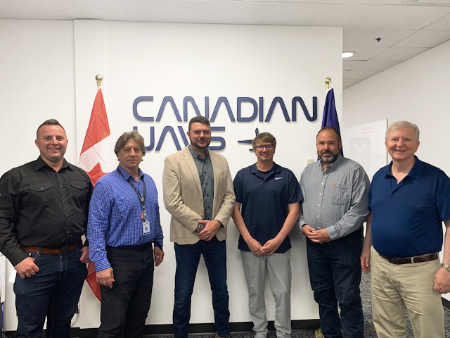
Datsa Dynamics LP and Ventus Geospatial have entered a strategic relationship that strengthens Canadian and Indigenous-owned capacity to deliver advanced aerial data, emissions monitoring and geospatial intelligence across the energy, mining, defence and infrastructure sectors.
The partnership creates one of Western Canada’s most comprehensive UAV and geospatial service offerings, combining advanced flight operations, specialized sensing technologies and data analytics under a single delivery model to reach new customers and pursue opportunities across Canada and internationally.
This integrated approach comes as demand for advanced aerial intelligence continues to grow across Canada’s defence, energy, mining and infrastructure sectors, where organizations are increasingly relying on UAVs and geospatial data to improve planning, monitor assets and support critical operations.
Ventus Geospatial brings an extensive inventory of UAV sensor technologies, including LiDAR and a patented methane detection sensor with applications across the North American oil and gas industry. Its geospatial data management platform provides advanced analytics and cost-effective data processing solutions. The company has established expertise in the petroleum, municipal and agricultural sectors, serving customers across Western Canada and several U.S. states.
Datsa Dynamics LP combines Canadian UAVs’ Beyond Visual Line of Sight (BVLOS) operational capabilities with Des Nedhe Group’s experience and relationships in the defence, mining and industrial sectors. This foundation positions the companies to introduce their respective technologies and services into markets where each has established experience.
Customers are looking for complete solutions, not JUST individual technologies,” said Mark Sombach, President of Datsa Dynamics LP. “This relationship brings together advanced BVLOS UAV operations, numerous types of specialized sensors, variety of different drones ranging from low end industrial to military grade and geospatial analytics, so we can support more of the customer’s project through one coordinated offering. It also gives both companies a strong platform to introduce proven technologies into new sectors and markets.”
The relationship also expands Indigenous participation in Canada’s advanced UAV and geospatial technology sector through Datsa Dynamics’ ownership structure and its connection to English River First Nation.
About Datsa Dynamics LP
Datsa Dynamics LP is a limited partnership between Des Nedhe Group, the Nation-owned economic development organization of English River First Nation in Saskatchewan, and Alberta-based Canadian UAVs, the largest drone operator in Canada with over 10,000 flight missions. The company combines Indigenous business leadership and established sector relationships with advanced UAV operations, including Beyond Visual Line of Sight capabilities. Datsa Dynamics provides aerial data acquisition, mapping, inspection and geospatial solutions for customers in the defence, mining, energy, infrastructure and environmental sectors.
About Ventus Geospatial
Ventus Geospatial is a Lethbridge, Alberta-based geospatial technology company specializing in UAV sensor technologies, LiDAR, methane detection, data management and advanced analytics. The company serves petroleum, municipal and agricultural customers across Western Canada and the United States.